Getting Outside During the Pandemic
Three local trails in Kitsap County to try as the weather improves
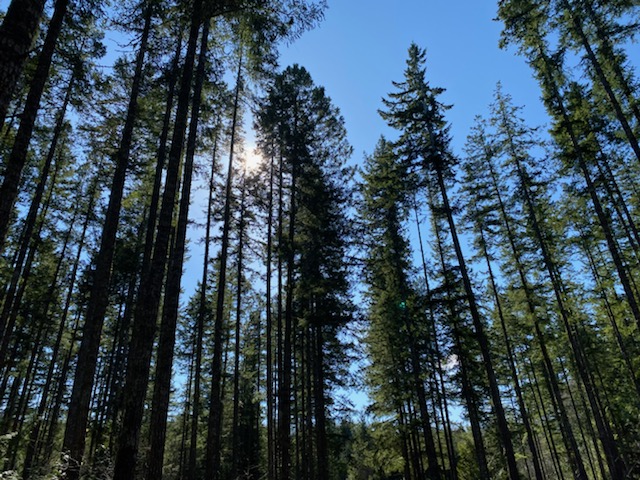
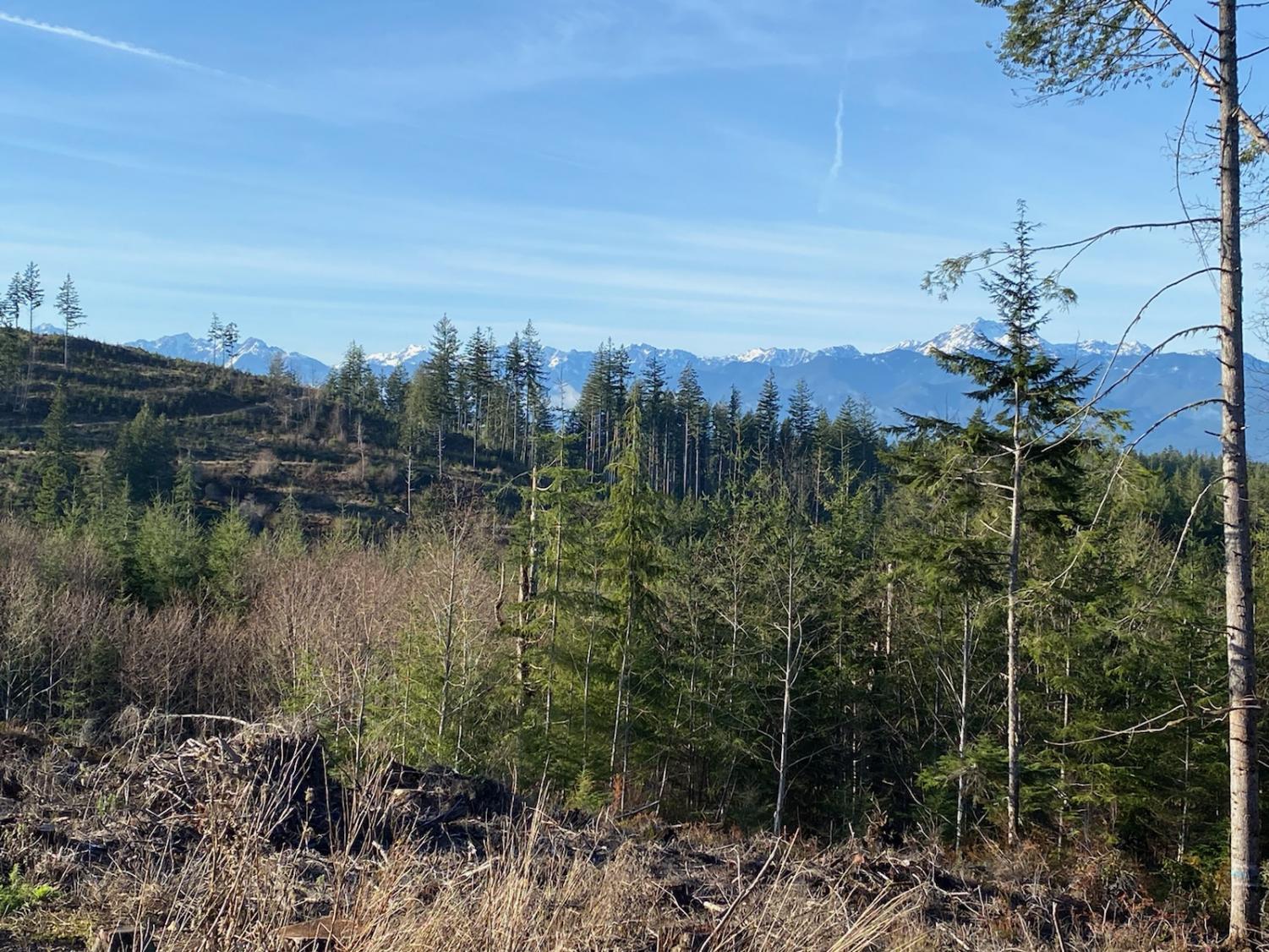
The sun shines through the trees on the Ueland Tree Farm trail.
As May begins, the spring season brings longer days and better weather to the Pacific Northwest. For Washingtonians who have been sheltering at home because of both COVID-19 and winter weather, this means more opportunities to get outside. For those looking for activity ranging from a leisurely walk to an intensive hike, three trails in the Kitsap region provide the perfect opportunity to enjoy the outdoors.
Ueland Tree Farm
Located off of Leber Lane in Bremerton, Ueland Tree Farm is a privately-owned tree farm that allows the public to access the land for the seven miles of different trails that go through the forest.
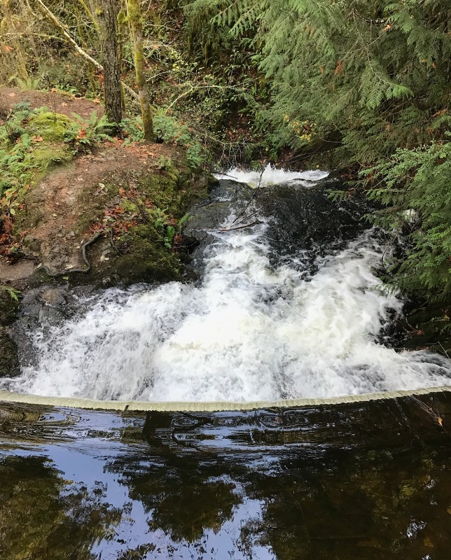
The Dickerson Trail takes hikers uphill for a brief while before evening out and joining with a gravel logging road, eventually leading to a side trail where hikers can cross over the top of a waterfall. This continues on to a short switchback trail that goes to a viewing point at the bottom of the picturesque falls. The walk to Dickerson Falls is a 1.6 mile round-trip hike.
If continued past the waterfall, Dickerson Trail leads to Zach’s Lookout, a 6.1 mile round-trip hike that leads to a lookout with an elevation of 1,040 feet. This trail is both longer and more intensive than the Dickerson Trail, as it includes an 800 foot elevation gain. According to the Ueland Tree Farm website, the view includes the Olympics, Mt. Baker, Hood Canal, and even Canada.
The South Loop trail consists of gravel logging roads as well, and is a mostly level trail.
Ueland Tree Farm provides a perfect place for a shaded walk or hike, with both flat and more uphill, intensive trails. Throughout the hike, there are plenty of photo opportunities: tree-filled valleys, rivers, lookouts, and a cascading waterfall.
All of the aforementioned trails are dog-friendly and allow horseback riding, biking, jogging, hiking, and berry and mushroom picking. Hikers are not required to hang a Washington State Discover Pass on their rear view mirror to access the trails.
Gold Creek Trailhead
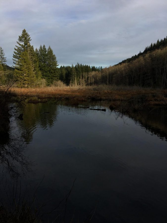
The Gold Creek Trailhead, located along Gold Creek Road in Bremerton, provides hikers access to multiple trails of different intensities and with different scenic features. Landmarks like ponds, beaver dams, rivers, and waterfalls of all sizes dot the trailside, providing plenty of places to stop and take a picture.
If hikers start down the Gold Creek Trailhead, they will find themselves on a worn path lined with trees that brighten the trail with transparent green leaves in the spring and summertime. Before the trail splits into two, hikers can view a waterfall to their left as they pass along a ravine; for those who are more adventurous, a steep switchback leads down to the waterfall and the river it feeds into.
At the 0.6 mile mark, hikers cross a bridge where the trail diverges into two separate directions–the Davis Trail or the Vista Trail.
The Vista Trail scales the side of Green Mountain, gaining 1000 feet in elevation to a mountain vista that with an elevation of 1639 feet. The hike is five miles round trip, with a steep incline; benches are provided at several points and once hikers reach an intersection with a logging road, they can sit in a cleared area and enjoy a view of the Olympic Mountains and the Olympic View Marina in Seabeck.
After the clearing, the trail continues through the woods to the final vista, with a view of Mt. Rainier, the Puget Sound, and, on a clear day, Seattle. The vista is furnished with picnic tables perfect for a mid-hike snack or picnic.
The Vista Trail also provides access to Plummer’s Trail, which goes along the other edge of the ravine that is visible at the beginning of the hike. Instead of continuing on the Vista Trail, Plummer’s Trail splits off on the left. If hikers ascend to the vista via Plummer’s Trail, they can come down the Vista Trail as a loop, or vice versa.
The Davis Trail is a moderate, flat trail, good for biking and jogging. If continued, it leads uphill to an abandoned tin mine; if hikers wish to explore the hole in the mountain, they should come equipped with a flashlight and waterproof shoes, as the mine has a small stream running through it.
After the tin mine, hikers can either go back the way they came or take the Davis Trail Loop back to the parking lot. The end of the loop consists of steep downhill switchbacks. Before descending, be sure to stop and enjoy the view of swathes of trees and the nearby Lake Tahuyeh.
The trails at the Gold Creek Trailhead are accessible for hikers, horseback riders, and bikers. Leashed dogs are permitted, along with motorcycles on specific trails. A Discover Pass is required to park in the lot, but some roadside parking is available. For those looking for a wide variety of destinations in a single region, the Gold Creek Trailhead is the perfect place to go.
Fort Ward Park
Accessible from both a northern trailhead on Pleasant Beach Drive and an eastern trailhead on Fort Ward Hill Road NE, Fort Ward Park provides both a walk through the trees and along the beach. Along with the scenery, the park allows hikers to walk through parts of naval history.
Fort Ward was built in 1903 to protect the Bremerton Naval Shipyard. During WWII, it served as a radio station and as a school for communication personnel. Although it was decommissioned in 1958, two concrete batteries remain for the public to view and explore.
To travel the full loop of the park, hikers should start at the northern trailhead and head up the steep hill; halfway up, the first battery is apparent. The trail levels out at the top of the hill and travels under the cover of towering maples and evergreens, until cutting through the eastern trailhead’s parking lot and heading downhill.
Once hikers have gone through the eastern trailhead’s parking lot and down the paved hill, they will find themselves at the site of the second battery, along a paved path. If followed to the left, it curves onto a beachside trail that passes by old military bunkhouses.
The paved path and the beachside trail, which is also accessible by the northern trailhead, would be ideal for those looking for a light walk.
Fort Ward is available for bikers, runners, and hikers, and has a public boat launch free of charge.
Hiking is a great way to get exercise and get outside; however, as the pandemic continues, those who choose to do so should abide by COVID-19 guidelines and any instructions posted at trailheads. Masks and social distancing are still recommended while on trails, but all three of the aforementioned trails provide plenty of space to enjoy and explore.